The Alaskan Capital City of Juneau has a lot of beautiful things to see and fun activities to do. Southeast Alaska is allows for quick access to a lot of different terrain to hike, waterways to explore, wildlife, and recent history that is well documented in our state and city museums. Here are a few locations that are easily reached by foot or by vehicle and that together can be seen in one day. Many of the places and activities available here are best enjoyed only during certain seasons (mostly summer) and require more then a day to fully experience. Following this map can also show you many other sites to see in passing as you explore Alaska’s Capital City.
Category: MyMaps
Place: Where to eat in Fairbanks, Alaska
My idea of travel and sightseeing is largely based on food. This is something I inherited from my family, particularly my maternal grandfather, who would meet guests at the airport with three dozen fresh bagels. He was convinced that without an immediate bagel infusion we would starve to death on the drive from the airport to his house, and I’ve never been entirely sure he was wrong.
There are many things to see and do in Fairbanks, particularly in summer when the days are endless. You can hike the trails, float the river, pick blueberries, party all night. But you can’t do any of those things on an empty stomach. So for the hungry traveler who has just arrived in Fairbanks, here are some small, local eateries that offer delicious and convenient meals.
Girdwood
The “flipped” structure of this assignment was new to me, but eye-opening. Using youtube and a course website to provide instruction without eating too much class time opens a number of possibilities for a teacher. Having that time instead for working on an assignment seems helpful for students, and it would free the teacher up to walk the room and help them individually with any problems they might be having.
My map walks you through my former home of Girdwood, Alaska, a small town near Anchorage (you probably know it for its mountain). I look forward to looking through your maps and haikus!
Juneau : The Constant Tourist
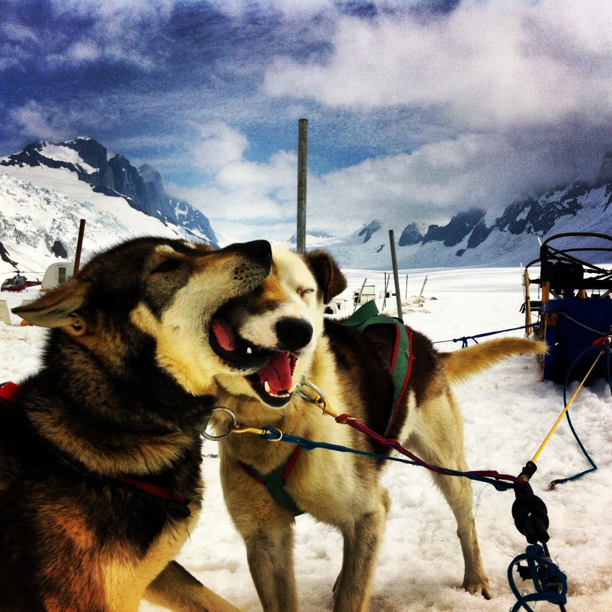
I came to Juneau for the first time in June of 2012. From May – September I didn’t live in Juneau proper, I lived 12 miles in on the Mendenhall Glacier at Dog Camp. We were a glacier dog sledding tour with 300 dogs and 18 people living on the ice. It was one of the most beautiful and desolate places I’ve ever lived. Many liken the experience to living on the moon, and even though we were only 12 miles away from downtown Juneau, it felt another world away. I came down off the glacier once a week for 24 hours and would explore Juneau in my free time. While I got to know parts of Juneau intimately, I am still a stranger to others. I view Juneau through the lens of a constant tourist.
In reflection on using My Maps, I believe this was a good way to show places to fellow users geographically, but I feel like this is still a shallow method of storytelling. I feel limited by only using texts and videos in the public domain. If I were a teacher I think I would use this as an introductory brainstorming technique, but I would want my students to go even further by creating their own video of place. Of course that is easier said than done!
My Schools: A Walking Tour
Born in 1970, I was a student in the Ketchikan Gateway Borough School District from 1975 to 1988. I attended three schools, two of which were in my neighborhood, Houghtaling Elementary School and Ketchikan High School (Kayhi). Attending Schoenbar Middle School, I rode the school bus, although I occasionally walked. The movie theater was downtown, which was nearly the distance to from my home to school, and I walked there all the time. I remember walking alone to Houghtaling Elementary from my first day of kindergarten. Following this walking tour is a great way to see Ketchikan as it takes you through historical downtown.
Denali West Buttress
After finishing my undergraduate studies at UAA four colleagues, friends and climbing partners and I climbed the West Buttress, the main climbing route, on Denali. Here is a map of our adventure:
I found this to be a little cumbersome to use. For instance you cannot change the angle of view like on google earth. Moreover, I had to redo the line of travel a number of times. Despite all of this I do believe this to be a useful tool especially when they upgrade it to have the same flow as google earth.
My Juneau Map; My life generally revolves around music and my kids.

This map highlights what Juneau from the viewpoint of a mother and a musician. The two sometimes overlap; I am a music teacher at the same school my children attend, and my children often accompany me to rehearsal….The outdoors play a big role in the lives of most Juneau residents; as a mom, the outdoors are less about trekking mountains and boating in the bay. The outdoors for my family are more about lakes and parks and playgrounds..