On Thursday, June 30th, from 5:30 to 7:30 we will gather at the cafeteria in the Mourant Building to celebrate the launch of the iBook project. With our group and invited guests, we’re anticipating 50 to 60 people total. There will be a grill available.
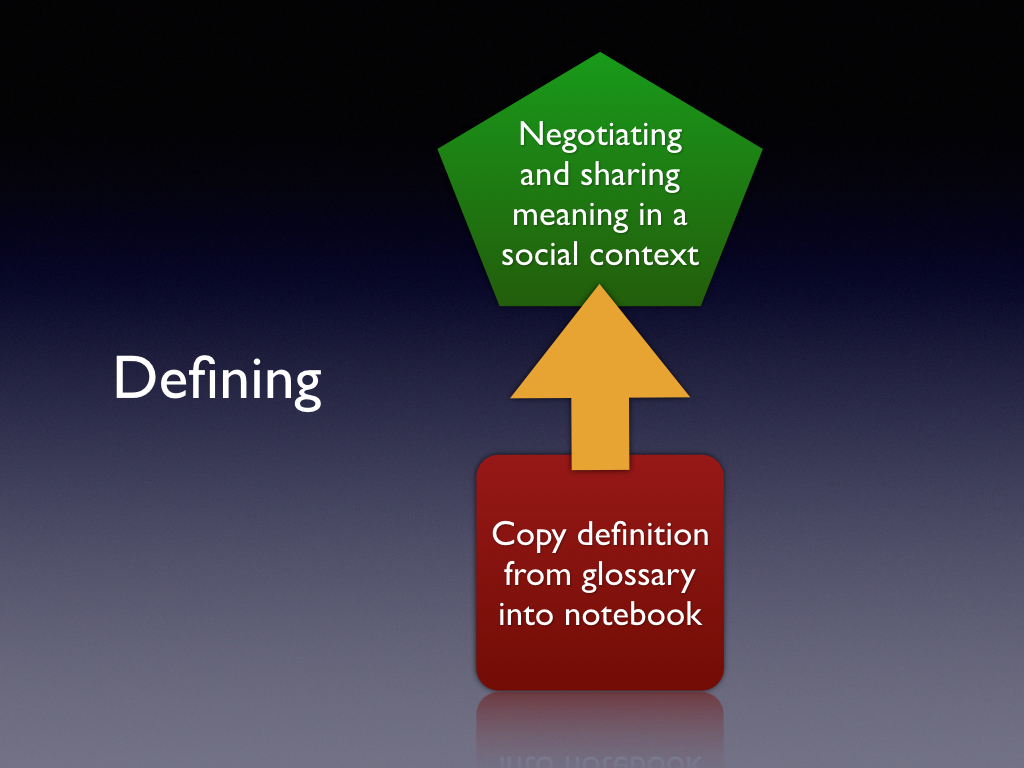
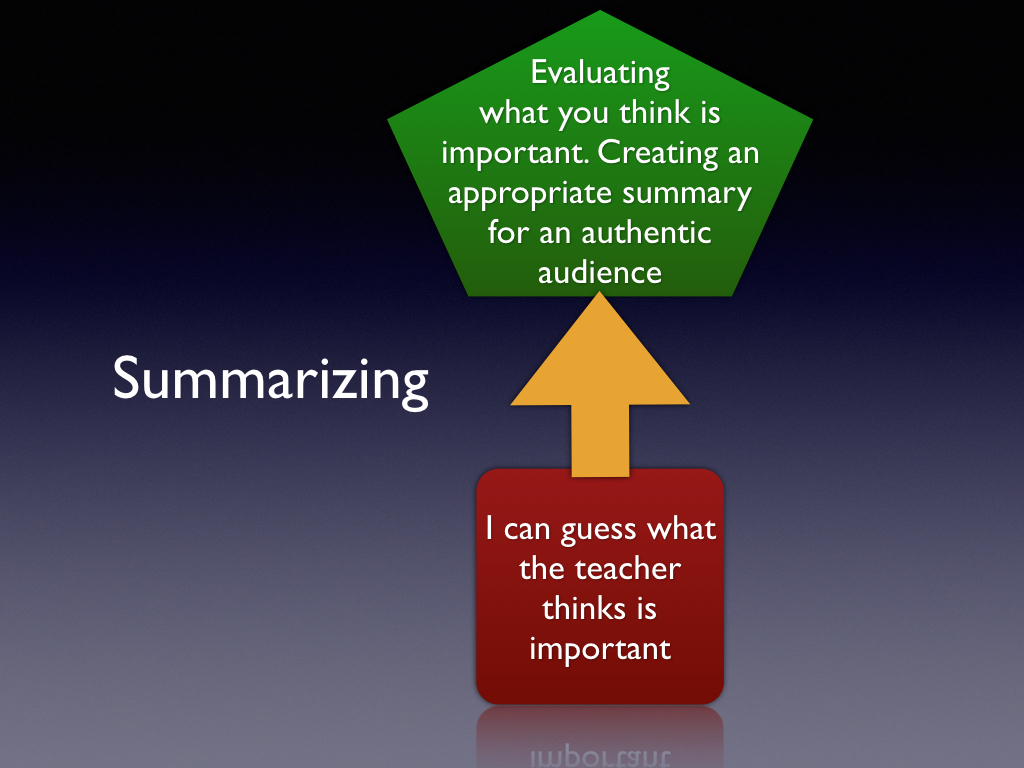
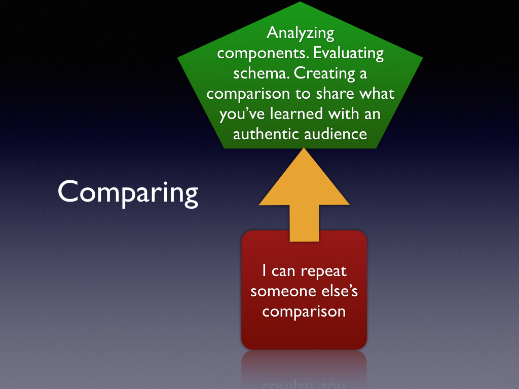
Today’s class will demonstrate how to embed literacy strategies into your project lesson – we will focus on 3 key strategies used across the curriculum – defining, summarizing and comparing. Click here Literacy strategies handout2MB pdf
Each design group should produce a rough draft of their intro in a shared Google Slide presentation. Each slide can roughly mimic a page of the iBook. Don’t worry about the layout and design. Instead focus on what text and images would be on each page. Google slides also allows you to quickly rearrange or insert / delete pages.
One student can create the initial Google slide presentation, then give permission to other group members as well as Angie and Peter to edit.
Design groups should collaborate on a chapter introduction that provides readers with background on the natural environment, built environment (surroundings created by and for humans) and culture of the indigenous people of the region. The bottom line: your intro needs to introduce the reader to how the indigenous people of the region found a way to thrive in that area.
The introduction could include maps, timeline, artifact photographs (including historical), graphs, videos, audio files, or other items that build background for the reader.
Essential understandings could include:
Identify and describe categories of characteristics that define a location as a place (e.g., weather characteristics, population density, flora / fauna, landforms).
Identify and describe the characteristics of the region’s physical environment that attracted people – and both limited and enabled them to thrive and prosper (e.g., climate, water, soil, landforms).
Describe the indigenous technologies that emerged in the region – clothing, housing, transportation, etc – and how they are a product of the natural environment. It could include examples of human modifications to the physical environment
Identify and describe the interaction of the geography, technology and the culture(s) of the people(s) of the region.
Describe historical highlights that are significant to understanding of the region and the interaction of indigenous and non-native peoples.
Image credit: McGuffey’s Reader illustration n.d.
Miami University Library: nn-1351
Time to give some initial form to your idea for a lesson. It should be a short “elevator pitch” with just enough information so that others can get a sense of what you’re working on. Please do this as a blog post due by Sat night 6/18. (Use the categories “student posts” and “idea”)
Students should plan to read their design groups ideas in prep for Monday’s class.
See if you can answer all five questions
Intended audience? Alaska region – grade, course, etc
About how much class time to do this lesson?
What’s the essential question? (is there one?)
What source material would students use (include a link or example).
A brief explanation of “what are the kids going to do?”
Be honest in your appraisal – if you’re stuck, others might be able to help you.
In preparation for this class I’d like students to
View: Who is the historian in your classroom? I’ve used the TEDEd flipped lesson feature to curate a existing YouTube and turn it into a lesson to support our class on historical thinking.
Our class begins with a review of the three assignments above
Today we begin our study of historical thinking skills based on the work of Sam Wineburg and the Stanford History Education Group (SHEG). We will focus on three key skills – Sourcing, Contextualizing and Corroborating. See historical thinking chart (pdf at SHEG).
Place is identified in terms of the relationships within and between physical characteristics (e.g. topography, vegetation, climate) and human characteristics (e.g. economic activity, settlement, land use). Places have distinctive features which give them meaning and character. A description of place, therefore, has an element of human subjectivity. The description depends on what characteristics about a place you choose to value and highlight and how you organize or classify that information. The Geography Toolkit
Students should read assignment and consider their response prior to our June 14 class where we will use class time for design work.
Assignment: Design a map representation of an Alaskan place. Preferably one you are familiar with or want to know more about. (As an alternative, Alaskan newbies can use a non-Alaskan location if they get stuck.)
Design your map using Google MyMaps and be sure to include at least 6 destinations. And be sure to attach about 10 content elements to the map – these could be photographs, videos or links to attractions. You may wish to design it as a walking or driving tour of your destinations.
All content should be geotagged to the map at its actual location (or close to it). The map can represent a contemporary setting or be based on a historic perspective. If you prefer you can design it from an indigenous perspective.
When your map is complete, embed it in a blog post that details what you hoped to convey in your map, and/or what you learned from the experience.
Background: Places are locations having distinctive features that give them meaning and character that differs from other locations. Therefore, places are human creations, and people’s lives are grounded in particular places. We come from a place, we live in a place, and we preserve and exhibit fierce pride over places.
Places are jointly characterized by their physical and human properties. Their physical characteristics include landforms, climate, soils, and hydrology. Things such as language, religion, political systems, economic systems, and population distribution are examples of human characteristics. Places change over time as both physical and human processes change and thus modify the characteristics of a place. Places change in size and complexity as a result of new knowledge, ideas, human migrations, climatic changes, or political conflicts. From National Geography standards
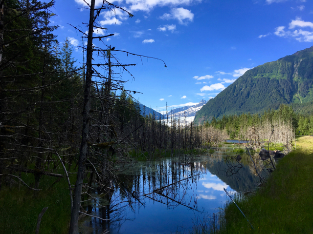
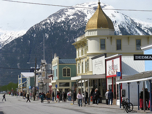
Image credit: Skagway, Alaskaby Jasperdo
Looking south on Broadway. The building with the gold dome is the Golden North Hotel, which was built by the Klondike Trading Company in 1898. “The Gateway to the Klondike”, Skagway served as the main stepping off point for the Klondike Gold Rush of 1898. Today, it is a well preserved, very historic town, in a beautiful setting.
